


Dune system of the A Insua cove


Shifting sand dunes
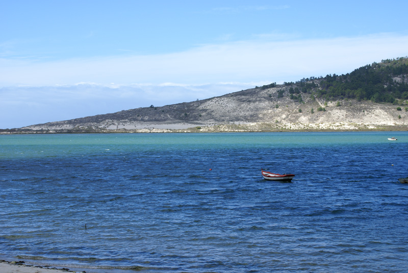
The A Insua cove dune system – popularly known as Dunas da Barra – separates the intertidal area of the Corme y Laxe estuary. This system comprises a set of shifting sand dunes nearly two kilometres long that averages 400 metres wide. The sand goes up the sides of Monte Branco as far as the Alto de As Travesas, where the view of Ponteceso, Cabana and the estuary is spectacular.

If you look towards the sea, you'll see how the dunes open up to the sea at the O Medio or A Barra beach, which you can reach via a path that passes right next to it without entering the beach.
Although this might seem like a safe place, the Laxe native poet Antón Zapata recounted that "Laxe women, when they hear a thundering sound on Barra beach, know that someone has died in the sea."
The dunes are home to an attractive landscape where the plant life has a crucial role in anchoring the sand. Here you will find the Omphalodes littoralis subsp. gallaecica, an endangered plant with an important local population for species preservation.
Other plant species you will find are European Marram grass – or European beachgrass – (Ammophila arenaria), sea lilies (Pancratium maritimun), marine thistle (Eryngium maritimum), Otanthus maritimus and Euphorbia paralias, among others.
From this point you have a nice view of the island of Os Cagallón and, at low tide, you'll be able to glimpse the shellfish gatherers from the Agrupación Río Anllóns harvesting cockles, one of the delicacies from these waters.
On the opposite bank of the estuary, in the territory of the Municipality of Cabana, you'll see the settlement of Canduas. Years ago, this spot – where traditional shipyard carpentry lives on – was the departure point for the boats that carried the locals by sea to the festivals in Corme with a stop at Balarés, thus avoiding a longer trip by road.
Why is Mount Branco white?
Ocean currents have plenty of energy to transport materials in suspension such as sand and particles from mollusc shells, which are deposited at the points where this force is weakest, forming beaches and strips of sand, such as the O Medio beach or the Balarés beach.

Once the sand has accumulated, the wind is responsible for transporting it, creating dune systems, which are formations resulting from this type of wind. In this sense, the O Medio or A Barra beach is a prime example, and you can observe dunes with different levels of stability, depending on how well anchored the sand is, which occurs over time with the specialised plants growing in these spaces.
Very close by is a peculiar geomorphological formation known as "Mount Branco". This is a hillside located right on the beach that, due to its windward orientation, the grains of sand from the dunes slowly climbed up, resulting in what are called "sand ramps", which on the Costa da Morte are called "white mountains". Hence the name "Monte Branco" ("White Mountain"). Other examples along the Costa da Morte can be seen in the Trece cove in Camariñas Thirteen, and in Soesto, in the neighbouring village of Laxe.
Links
- How to reach A Insua cove dune system
- + info Omphalodes littoralis subsp. gallaecica
- Video mount Branco and A Insua cove dune system
- Video about harvesting cockles: "Held by Women"